

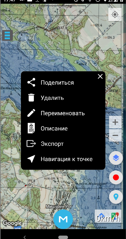
Improved navigation to point
First, I decided to rename this feature to “Navigation to Point.” I believe this will make it clearer for new users, while existing users likely won’t mind the change.
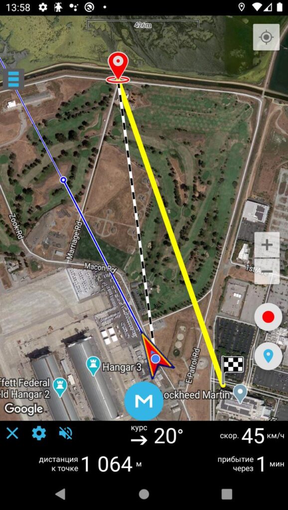
Based on feedback and emails, users requested more navigation indicators and a couple of additional lines on the map.
Yellow line: Still represents the initial route.
Black-and-white dashed line: Indicates the shortest current path to the point.
Blue line: Shows your current direction of travel, i.e., where your path will lead if you continue moving in the same direction.
Blue ring on the blue line: Indicates the spot where you’ll be in one minute if you maintain the same direction and speed.
In addition to the distance to the point, new indicators include bearing to the point, current speed, and estimated time of arrival (ETA).
I also updated the icons for the start and end points of the route. The previous icons (fish and grandpa) seemed outdated. They were amusing but not very practical in real-world conditions. Navigation can now also be started directly from the point list, not just the map.
If you have any feedback on these changes, please share via email or in the comments. I’m always listening.
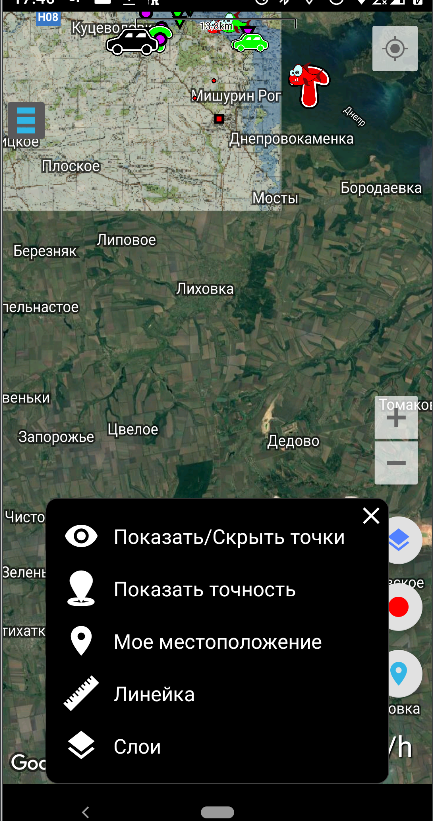
Layer management improvements
While the changes here are small, they’re quite important.
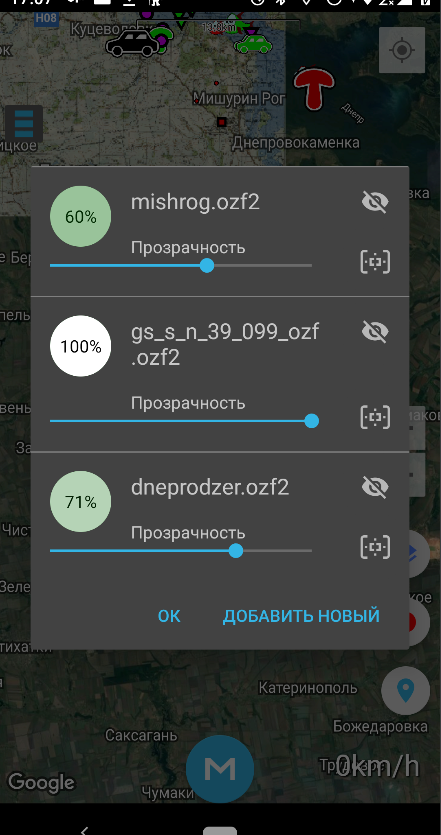
The cross icon has been replaced with an eye icon. The cross caused a lot of confusion: some users thought it simply closed the dialog window, clicked it, and then emailed me saying their purchased maps disappeared. Others thought it permanently deleted the map and kept unnecessary layers on the map out of fear. The eye icon should more accurately represent the function of this button.
Added a focus button for layers. As an active app user, I often struggled with identifying layers in a list of maps with cryptic names. For example, when trying to remove unnecessary layers, you’d have to adjust the transparency of each one individually to figure out which map it belongs to. This was time-consuming and frustrating. Now it’s simple — press the focus button, and the map zooms to the selected layer.
Wear OS smartwatch support
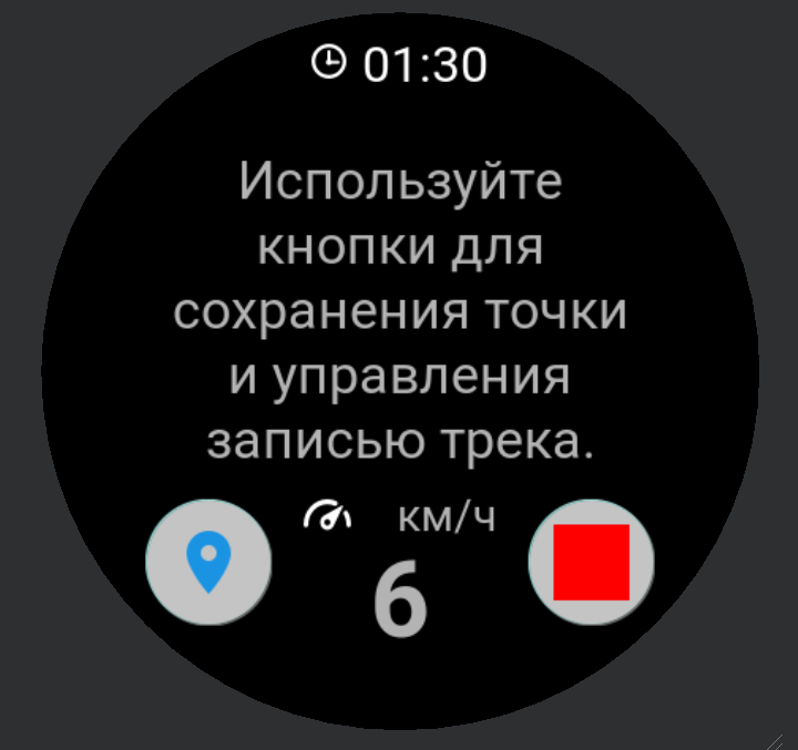
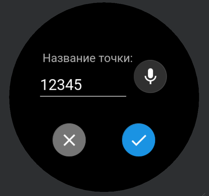
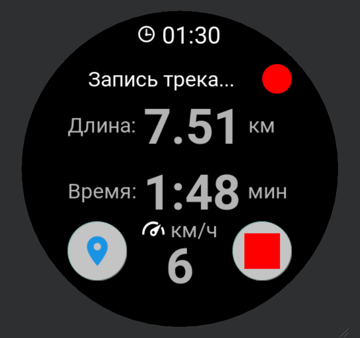
It’s finally here! I’ve been planning this for a long time, but other app improvements always took priority. The potential of having a device on your wrist is enormous, and I’m already excited about how convenient future features will be.
For now, I’ve implemented only the basics: saving a point and recording a track. It’s genuinely handy to save a point or start track recording without pulling your phone out of your pocket.
The next major feature for smartwatches will be “Navigation to Point.” I can’t wait to try it and share it with you.
Android 10 issues resolved
This version of the operating system introduced a feature allowing users to grant location access only while the app is active or also in the background. This caused problems with background functionality — when the screen turned off, track recording and navigation to point would stop. Additionally, many phone models automatically restricted background location access for all apps by default upon upgrading to Android 10.
These scenarios are now fully addressed and handled.
Other minor updates
Dialog windows in the menu were slightly updated, with icons added to the options. I think it looks significantly better this way.
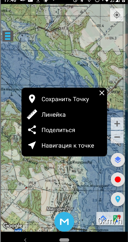
Long pressing on the map now offers more options, such as measuring the distance to a selected location, enabling navigation without saving the point, and other features.