

Improved accuracy when saving a point
I tried to get the most out of mobile GPS capabilities. Of course, this doesn’t mean you’ll get centimeter-level accuracy while sitting in a basement 🙂 but overall, the margin of error in determining coordinates has been significantly reduced.
Additionally, users have recently reported that on some devices, sometimes a saved point ends up far from the actual location. I’ve found the cause and fixed it.
Displaying multiple tracks simultaneously
This was probably one of the most requested features based on user feedback. I delayed it for a long time because it wasn’t as simple as it might seem. But it’s finally here!
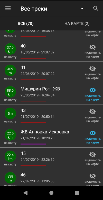
From the track list screen, you can choose which tracks will be visible on the map and which won’t. If you press the “ON MAP” button in the top-right corner, you’ll see a list of only those tracks currently displayed on the map.
Experienced users know what happens if you press the green circle, but new users often ask questions. To clarify, I’ve added small text hints in the new version.
Under the date, you may notice a line — this is what the track line looks like on the map.
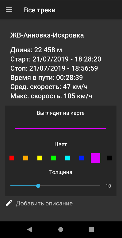
Now, multiple tracks can be displayed simultaneously. To help distinguish them on the map, I’ve added options to change their color and thickness.
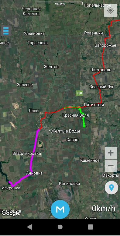
Here’s how it now looks on the map.
So don’t hesitate to send me your feedback and ideas. As you can see, all good ideas will be implemented sooner or later!
Other improvements
When entering coordinates manually, there used to be an option called “Enter text from SMS.”
The text format has since changed, and this no longer worked as intended. I’ve reworked this feature into “Enter text with coordinates.”
The idea is simple: you paste any text containing coordinates, and the program extracts the coordinates from the text and saves a point based on them.
- Added the ability to import routes (route) from GPX files. For now, they are simply saved as tracks. In the future, I plan to introduce functionality specifically for routes, processing them differently.
- Added a “Cancel” button to the point save dialog window.
- Improved search for points and tracks. Now, the search works not only by matching names but also by descriptions. Another issue was case sensitivity: for example, if a point started with a capital letter, entering its name in lowercase wouldn’t find it. This has also been fixed.
- In update 1.45, I added the ability to rotate the screen to landscape orientation. This can be enabled in the app settings.