
The main focus was on solving issues related to new and still unpolished features, such as map downloading and the new point search mode. In addition, several highly useful features were added, in my opinion. Of course, there are also new map sets. Let’s go through everything step by step 🙂
Resolving map issues
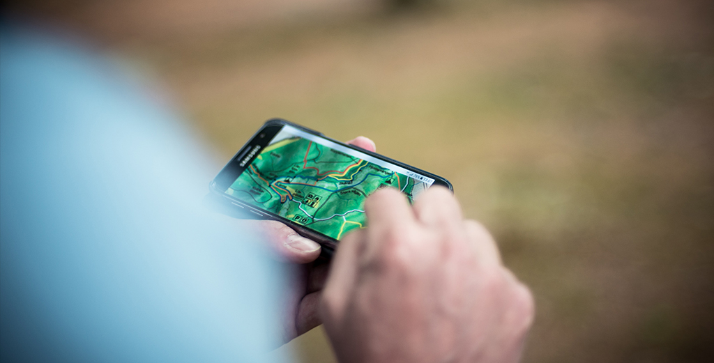
A few months ago, I added a new feature – downloading various thematic maps for fishing and other activities. This feature was well-received by many users. Despite the fact that the offline map functionality had been around for a long time, very few people used it. Maps had to be created manually or found online, which discouraged many. Now downloading maps is available directly from the app.
However, there were some issues. In previous versions of the app, purchased maps were placed in the general downloads folder (Download) to avoid creating a separate folder for maps and all that. Later, I regretted this decision many times. Essentially, downloads is a dumping ground where maps get mixed with all kinds of junk. Not fully understanding how offline maps work in the app, some users accidentally deleted map files while cleaning up their phone storage, which led to purchased maps disappearing. Additionally, various cleaner apps contributed to the deletion of maps. As a result – dissatisfied users and negative reviews in the Play Market.
Now I’ve resolved this problem – purchased maps are placed in a separate folder – “SUSANIN_MAPS,” where they are safer than in downloads. I also reviewed, tested, and fine-tuned the mechanism for downloading paid maps to eliminate any chance of accidental loss or other unpleasant issues.
The next problem was the inability to preview the map before purchase. Many users were dissatisfied with the quality or content of the map. Again, bad reviews and ratings. I repeatedly wrote everywhere – “If you’re unsure, email me, and I’ll send you screenshots of the maps you’re interested in.” But many didn’t see or ignored this. They bought maps and then complained.
Now I’ve added the ability to preview maps before purchase!
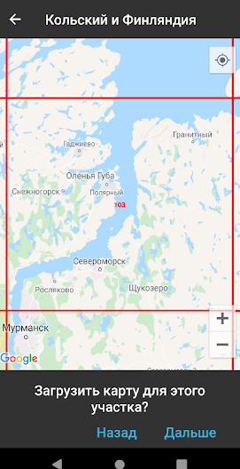
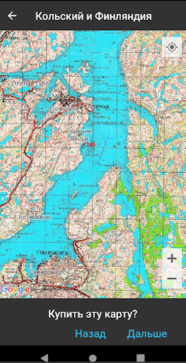
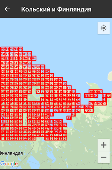
Finally, about maps, I’ve added three new map sets:
- Kola Peninsula, northern Finland, and some adjacent areas.
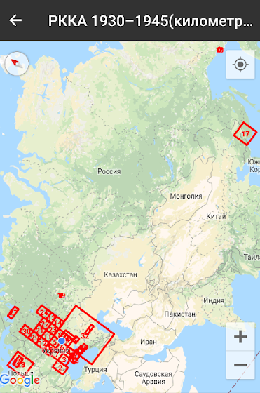
- RKKA kilometer maps
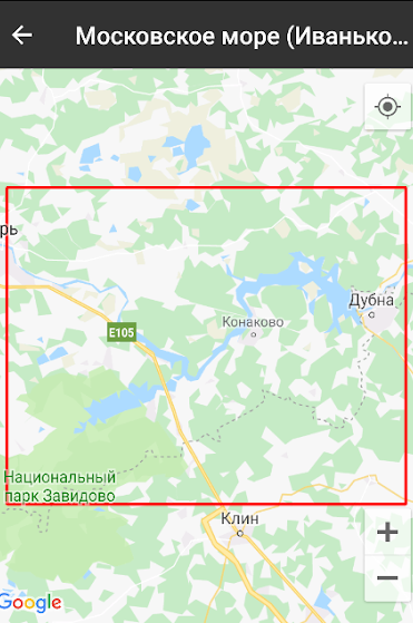
- Ivankovo Reservoir (also known as the Moscow Sea)
Revolutionary new points
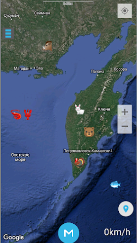
Back in mid-winter, I had an idea: if I made it possible to display points as text on the map, it would significantly expand the variety and capabilities of points. Why did I need this? First and foremost, I wanted to mark my depth measurements on the map, thus creating something similar to Garmin depth maps. Then, I made a prototype, experimented with it a bit, and I really liked the result.
I created a simple tool for measuring depth: the cheapest 0.3 fishing line reel, a 30g weight, and knots tied every meter – smaller, lighter, more autonomous, and reliable than any fish finder 🙂 The ice near the bottom wasn’t particularly thick, and I broke through it in a few hits with a spud. When the fish weren’t biting, I walked around drilling holes, measuring depths, and immediately saving points, looking for slopes, holes, river bends, etc. The results of this work look something like this:
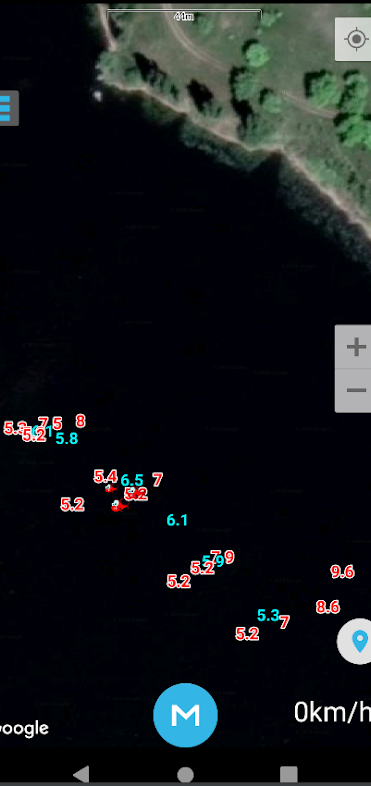
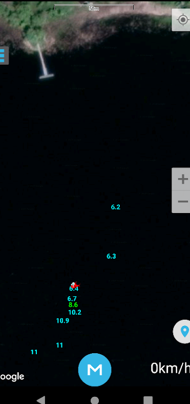
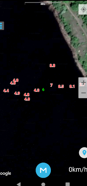
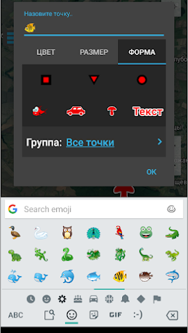
Impressive, isn’t it? I think most fishing users will use these new points in exactly this way. But the possibilities are much broader. “Text” is now another point form in the app. Like other points, text can also have its color and size adjusted.
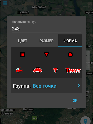
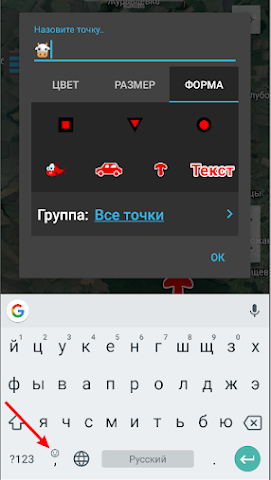
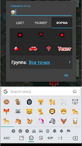
Later, I accidentally discovered another interesting possibility. If I’m not mistaken, starting with Android 7, standard keyboards support emojis – small images that evolved from smileys. These are also text, meaning they can now be used to mark points! I browsed through them a bit and saw that there’s an image for almost every occasion 🙂
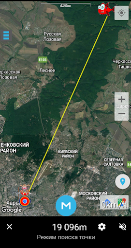
Point search mode
Before the previous update release, I was very busy and didn’t write an article about its new features. So it’s worth saying a couple of words about it as a preface.
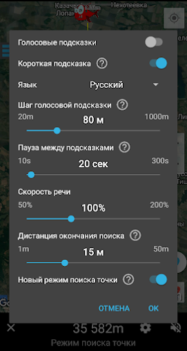
The main goal of the previous update was to improve the old point search mode. First, the voice prompts were replaced with a computer-generated voice. It’s louder, clearer, and probably more pleasant (female). Previously, my own voice, recorded ages ago on a cheap recorder, was used. The interface for managing the point search mode was also significantly improved, and more settings were added.
Unfortunately, the computer-generated voice didn’t work on some devices 🙁 I anticipated this situation and added the option for users to choose between the updated and old point search modes.
However, what I didn’t account for was that the old point search mode was slightly broken. Switching to the old mode caused the app to crash when getting too close to the point.
Now this issue has been fixed and thoroughly tested. You can confidently use both the new and old point search modes.
Other fixes
In addition to the above, user feedback and my observations resulted in the following:
- Added another point color – black (quite relevant for the new point form – “text”).
- When saving a new point, its properties (color, size, form) are inherited from the previous saved point by default. If you don’t like this, let me know, and I’ll add an option to disable this behavior in the settings.
- Fixed numerous bugs related to importing and exporting points and tracks (opening gpx files by clicking on them, errors importing gpx files from Garmin devices, crashes when exporting selected points from the list, and other minor issues).
As you can see, we’re not standing still and are actively working to improve. If you have any feedback or suggestions, feel free to email me, reach out on social media groups, or leave a review in the Play Market.
Все устраивает
Все класс.
Все устраивает.